Pictured Rocks Lakeshore Trail is the premier backpacking trail located on the Southern Coast of Lake Superior. Stretching 42 miles it is a 2-4 day point to point through the Pictured Rocks National Lakeshore passing waterfalls, coastal cliffs, remote beaches, and coastal dunes. While often overlooked by its ocean counterparts, the trail should be in contention for being the best coastal hike in the United States.
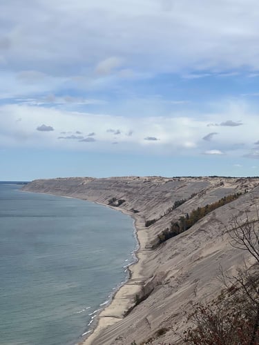
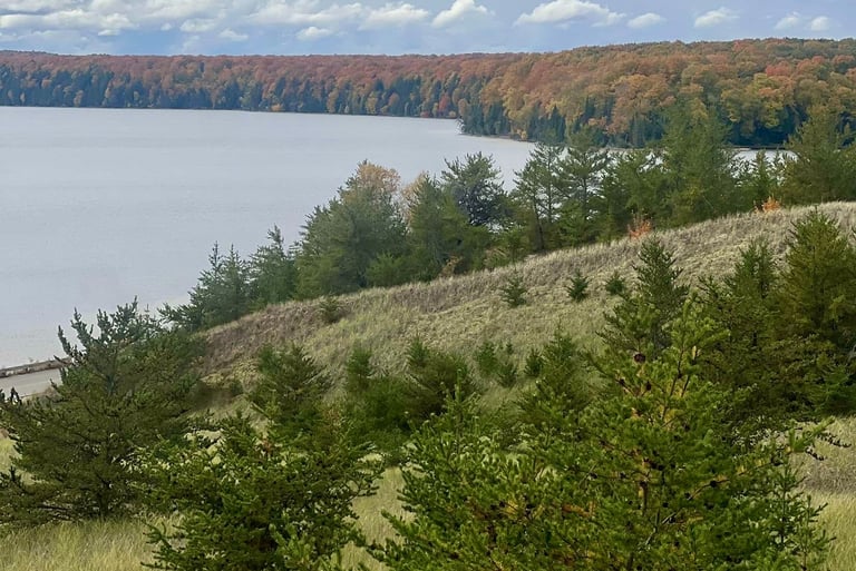
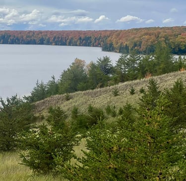
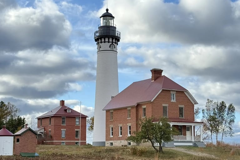
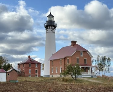
The trail starts in at the Grand Sable Visitor Center two miles west of Grand Marias, this part of the trail initally runs along the road along Grand Sable Lake, while here there is a short sand spur that you can climb that gives a view of Grand Sable Lake that is especially stunning in the fall. The trail then ducks into the woods behind the coastal Grand Sable dunes. The next section of the trail runs through the forest as it traverses behind the Grand Sable Dune system until you arrive at logslide overlook, which provides a commanding view of Grand Sable Lighthouse and Lake Superior. The trail then descends the Grand Sable dunes before approaching the Grand Sable Lighthouse. Thorughout this section there are small beach areas that you can look back at the Grand Sable Dunes.
The trail then follows an old access road from the lighthouse until you reach Hurricane River, here you will find a rushing river leading into Lake Superior. From here you enter the most remote section of trail as you traverse 12 mile beach, which as its name suggests is 12 miles long. Along this stretch there is countless rock hunting opportunities, as you can look for the famous Agate rocks. After the beach you will eventually reach the cove area, this section of coast has multiple cove inlets that provide excellent swimming coves the most famous of these being Big Star Cove an inlet that allows diving and wide rock ledges to swim. This section of coast also has virtually no people.
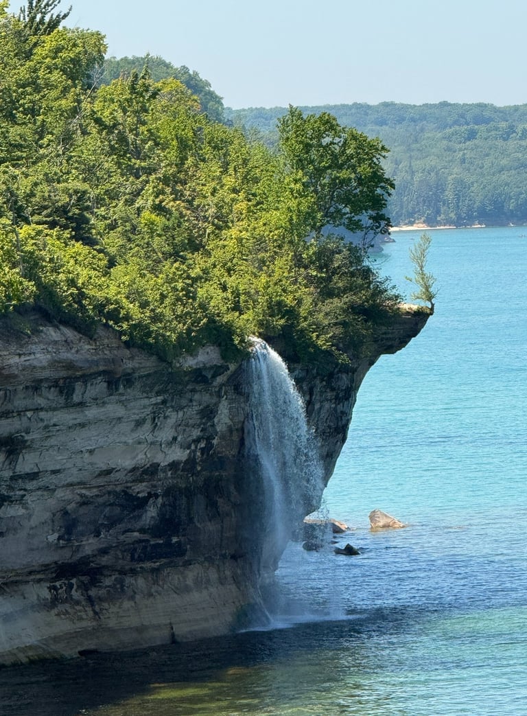
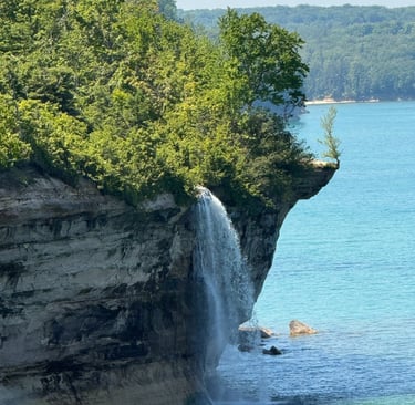
From Big Star the cliffs begin to slowly rise until you reach Spray Falls. Spray falls is unique in that it is a year round waterfall that falls over the cliffs directly into Lake Superior. The falls has two overlooks with the best view being before arriving to the falls. Once reaching Spray creek there is an overlook that gives a limited view but allows you to see the crest. These falls flow year round but the strongest flow is generally earlier in the season.
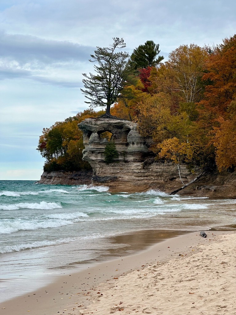
Continuing on the trail you will eventaully reach Chapel Beach, here there is a small overlook to look at the rock and some history on its formation, taking a left you will reach chapel creek and chapel beach falls, which is a small waterfall onto the beach, here there is a rocky outcrop which serves as a good picnic spot or place for rest. Just across the creek you will also find newly built vault toilets and the chapel beach campsites, these campsites provide quite a bit of privacy and are tucked back into the woods with a short walk to the beach. The rest of the beach is sandy with ladders providing access to the beach from the bluffs. Note, this area can get quite busy in the summer months, to escape the crowds move down the beach away from Chapel Rock or pro-tip descend to the beach before crossing chapel creek.
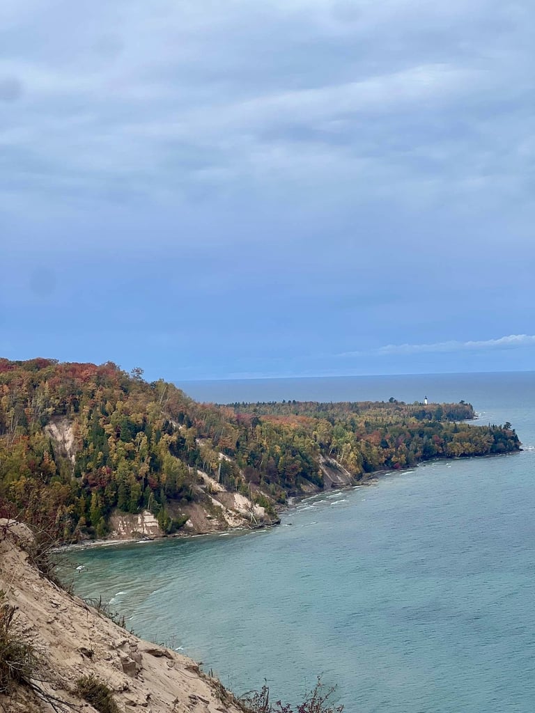
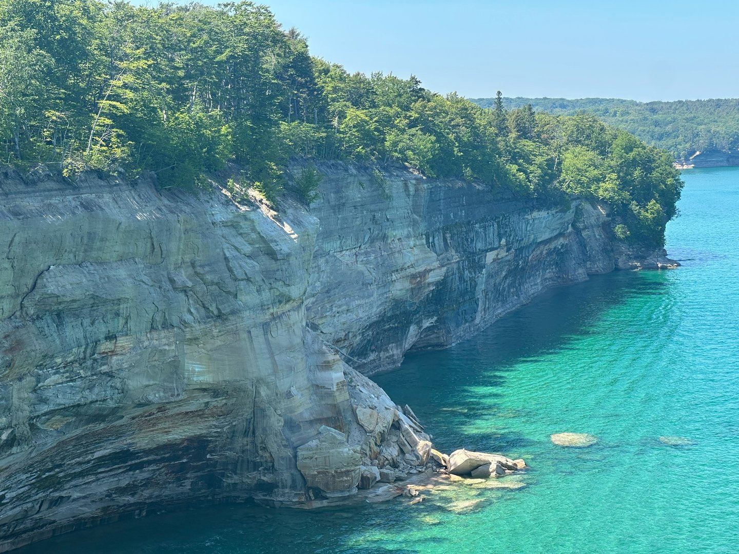
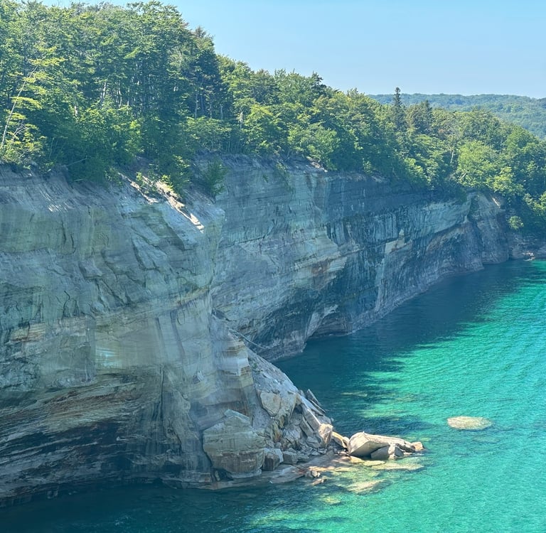
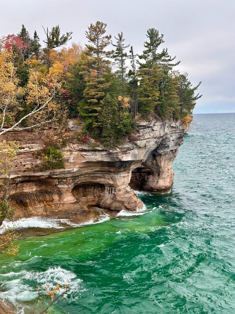
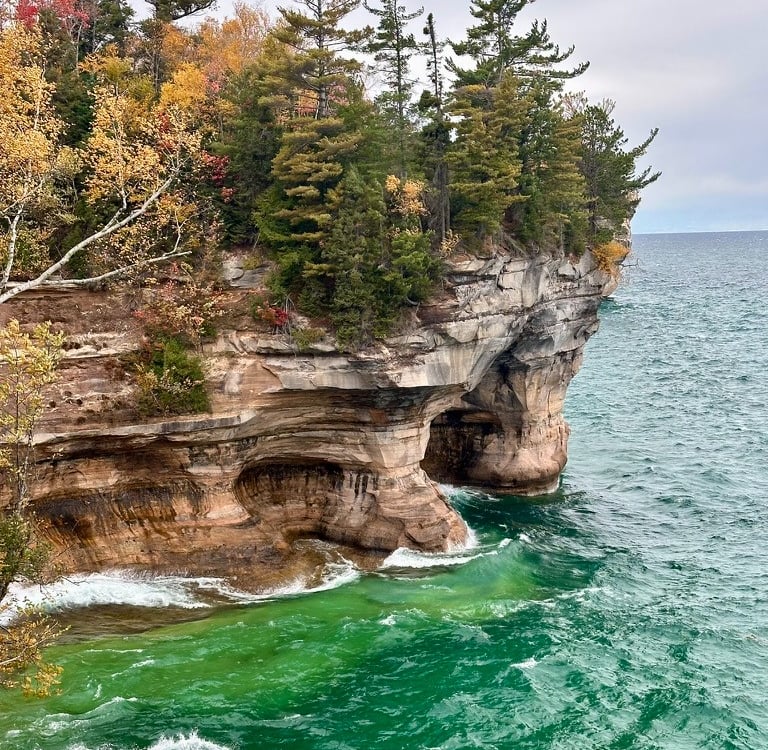
Continuing on the next site of note is big star cove, this spot is hidden but after ascending the stairs from chapel beach there will be an unofficial trail that leads you to the cove. Continuing on from the cove there will be several more lookout points just off the trail, I recommend that if you see a side trail generally follow it if time permits, as these spurs often provide worthwhile overlooks of the coastline, with this section providing some of the best views of the rocks and Grand Portal Point in the distance. After a mile or so of hiking you will reach Grand Portal Point. Here there will be a large treeless overlook where you can view up and down the coastline of the cliffface. At this point you can see multiple recent cliff collapses into Lake Superior a reminder of the ever changing nature of the coastline. The next section of the trail provides more limited overlooks but provides a nice walk through the forest, this section is generally where you start to feel the wear and tear of the hike. After a couple of miles you will reach an overlook that provides a commanding view of Lovers Leap, the iconic sea arch in the national park, the best view is from the distance, however there are a couple viewpoints closer to the arch that provide partial views. A little further beyond that you will reach mosquito beach. Despite its name and being overshadowed by its more popular cousin Chapel Beach, this beach is a personal favorite in Michigan. The coastline is layered rock that provides a unique beach experience in Michigan, additionally on warm summer days the beach provides the fault, a sudden drop off providing excellent swimming opportunities. Another insider tip, on the North side of the beach you can walk around the headline to a secret sea cave and swimming hole. I would only recommend this on calm summer days, as when waves are present the caves may be unreachable. If you continue hiking down the beach the rock eventually gives way to sand on the opposing side of Mosquito creek. Along the creek you will also find camping sites with site 3 being on Mosquito creek while the rest are tucked into the woods a short distance from the beach. After finishing at Mosquito beach, the hike then heads inland, this section when doing this as a day hike can be brutal and is often muddy, though the park service is in various stages of installing a boardwalk. Depending on energy you can tag on Mosquito Falls, a small cascade in the woods. Two miles later, after crossing Chapel Creek you will reach the parking lot and complete the loop.
Budget
This trek
Best Time of Year